
Marine and Coastal Resources
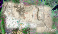
Sanctuary Integrated Monitoring Network (SIMoN)
for Monterey Bay National Marine Sanctuary
 More
than 40 institutions and organizations in the greater Monterey
Bay area are currently examining various aspects of the Monterey
Bay National Marine Sanctuary, an internationally recognized location
for marine research, resource management, and policy. Marine research
conducted in the sanctuary includes long-term monitoring programs
that are essential to furthering understanding and determining
the health of the marine ecosystem. The Sanctuary Integrated Monitoring
Network (SIMoN) enables researchers to monitor the Monterey Bay
National Marine Sanctuary effectively by integrating the existing
monitoring programs, and making the data available to managers,
decision makers, the research community, and the general public.
SIMoN uses Telemorphic's MaplicityJSP and ESRI's ArcIMS as their
Internet Geographic Information System (GIS) for disseminating
geospatial content to their customers and constituents.
More
than 40 institutions and organizations in the greater Monterey
Bay area are currently examining various aspects of the Monterey
Bay National Marine Sanctuary, an internationally recognized location
for marine research, resource management, and policy. Marine research
conducted in the sanctuary includes long-term monitoring programs
that are essential to furthering understanding and determining
the health of the marine ecosystem. The Sanctuary Integrated Monitoring
Network (SIMoN) enables researchers to monitor the Monterey Bay
National Marine Sanctuary effectively by integrating the existing
monitoring programs, and making the data available to managers,
decision makers, the research community, and the general public.
SIMoN uses Telemorphic's MaplicityJSP and ESRI's ArcIMS as their
Internet Geographic Information System (GIS) for disseminating
geospatial content to their customers and constituents.
Tampa Bay Estuary Imagery System for Florida Marine Research Institute
 Seagrass
provides an important indicator of environmental health in bays
and estuaries. In August 2000, a Seagrass Management Symposium
brought over 70 resource managers and researchers together to
discuss status and trends of seagrass and water quality in Florida
estuaries. A top priority identified by these experts was improved
access to digital data for historic and current seagrass extent
and an archive for photographs and maps. To address this information
requirement, a consortium
of federal and state government organizations teamed to produce
a website providing on-line access to multiple years of aerial
photography (1926-2002) and digital maps for the Tampa Bay region.
The resulting Tampa Bay Estuary Imagery System enables researchers
to conduct interactive visual evaluations of study sites, assess
trends in benthic habitats and coastal landuse/landcover, and
create/print/download custom images and maps. The site also provides
an on-line geospatial reference for coastal development through
recent history available to both researchers and the general public.
The system is powered by Telemorphic's Maplicity and ESRI's ArcIMS.
Seagrass
provides an important indicator of environmental health in bays
and estuaries. In August 2000, a Seagrass Management Symposium
brought over 70 resource managers and researchers together to
discuss status and trends of seagrass and water quality in Florida
estuaries. A top priority identified by these experts was improved
access to digital data for historic and current seagrass extent
and an archive for photographs and maps. To address this information
requirement, a consortium
of federal and state government organizations teamed to produce
a website providing on-line access to multiple years of aerial
photography (1926-2002) and digital maps for the Tampa Bay region.
The resulting Tampa Bay Estuary Imagery System enables researchers
to conduct interactive visual evaluations of study sites, assess
trends in benthic habitats and coastal landuse/landcover, and
create/print/download custom images and maps. The site also provides
an on-line geospatial reference for coastal development through
recent history available to both researchers and the general public.
The system is powered by Telemorphic's Maplicity and ESRI's ArcIMS.