
Humanitarian Relief
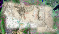
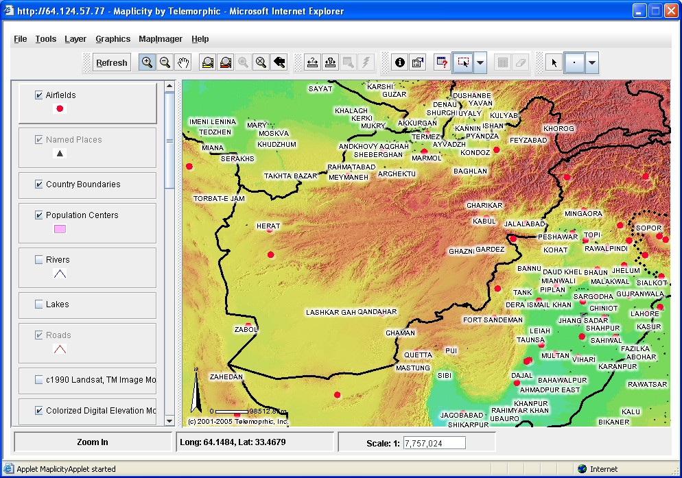
Afghanistan Internet GIS and Satellite Image Visualization System
 Following
the war in Afghanistan and removal of the Taliban regime, thousands
of workers from humanitarian organizations, government agencies,
private companies, and other non-governmental organizations involved
in relief and reconstruction required basic geographical information
in order to prepare for their deployment to the region. Many of
these people found the necessary maps and satellite imagery using
the Afghanistan Internet GIS and Satellite Image Visualization
System, a free public access resource created and hosted by Telemorphic,
Inc. The Maplicity-powered system has delivered web GIS tools
along with hundreds of thousands of maps and satellite images
to people around the world. To create the site, Telemorphic aggregated
massive archives of declassified maps and imagery from official
US Government sources such as Dept. of Defense (NGA/NIMA), NASA,
and USGS. While this geospatial information was previously available
to the public in cryptic data formats and a few obscure ftp and
websites, it was not accessible for practical use by the masses
in a "real world" web mapping application. This resource has been
continuously updated with additional content, and remains one
of the most popular web mapping resources for Afghanistan and
Pakistan. Live Demo
Following
the war in Afghanistan and removal of the Taliban regime, thousands
of workers from humanitarian organizations, government agencies,
private companies, and other non-governmental organizations involved
in relief and reconstruction required basic geographical information
in order to prepare for their deployment to the region. Many of
these people found the necessary maps and satellite imagery using
the Afghanistan Internet GIS and Satellite Image Visualization
System, a free public access resource created and hosted by Telemorphic,
Inc. The Maplicity-powered system has delivered web GIS tools
along with hundreds of thousands of maps and satellite images
to people around the world. To create the site, Telemorphic aggregated
massive archives of declassified maps and imagery from official
US Government sources such as Dept. of Defense (NGA/NIMA), NASA,
and USGS. While this geospatial information was previously available
to the public in cryptic data formats and a few obscure ftp and
websites, it was not accessible for practical use by the masses
in a "real world" web mapping application. This resource has been
continuously updated with additional content, and remains one
of the most popular web mapping resources for Afghanistan and
Pakistan. Live Demo
Tsunami Damage Assessment in Banda Aceh
with
MapImager On-Line
 Technologies
for mapping, GIS, and GPS can play a critical role in damage assessment
and recovery following a natural disaster. Unfortunately, such
technologies are often expensive, complex, and time consuming
to establish, maintain, and deploy. Telemorphic's MapImager On-Line
provides reliable, easy-to-use web browser access to interactive
imagery comparison, visualization, mapping, and GIS tools delivered
complete with map and imagery content via the web. These powerful
tools allow anyone with web browser access to view maps and imagery
depicting the local geographic situation, create/save/print custom
maps, and share them with colleagues... next door, down the street,
or around the world. For Banda Aceh, high resolution satellite
images taken before and after the Tsunami were made available
for public access using MapImager On-Line, enabling interactive
on-line image comparisons that reveal the damage caused by the
event. Web GIS tools are also included allowing for users to quickly
zoom to GPS coordinate, make accurate measurements of areas, and
redline/markup the images to create custom maps for the city. Live Demo
Technologies
for mapping, GIS, and GPS can play a critical role in damage assessment
and recovery following a natural disaster. Unfortunately, such
technologies are often expensive, complex, and time consuming
to establish, maintain, and deploy. Telemorphic's MapImager On-Line
provides reliable, easy-to-use web browser access to interactive
imagery comparison, visualization, mapping, and GIS tools delivered
complete with map and imagery content via the web. These powerful
tools allow anyone with web browser access to view maps and imagery
depicting the local geographic situation, create/save/print custom
maps, and share them with colleagues... next door, down the street,
or around the world. For Banda Aceh, high resolution satellite
images taken before and after the Tsunami were made available
for public access using MapImager On-Line, enabling interactive
on-line image comparisons that reveal the damage caused by the
event. Web GIS tools are also included allowing for users to quickly
zoom to GPS coordinate, make accurate measurements of areas, and
redline/markup the images to create custom maps for the city. Live Demo